Tour du Vançon
Sisteron Medium
Tour du Vançon
4j
61,4km
+2667m
-2666m
Embed this item to access it offline
Our favorites:
- Backpacking adventures
- Lodging nestled in unspoiled nature
- Homemade meals made with local ingredients
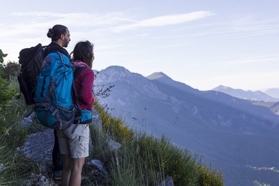
- Breathtaking landscapes and views of the Monges and the surrounding mountain ranges (Ecrins, Ubaye, Dévoluy...)
- Backpacking adventures
- Lodging nestled in unspoiled nature
- Homemade meals made with local ingredients
- Breathtaking landscapes and views of the Monges and the surrounding mountain ranges (Ecrins, Ubaye, Dévoluy...)
4 steps
Description
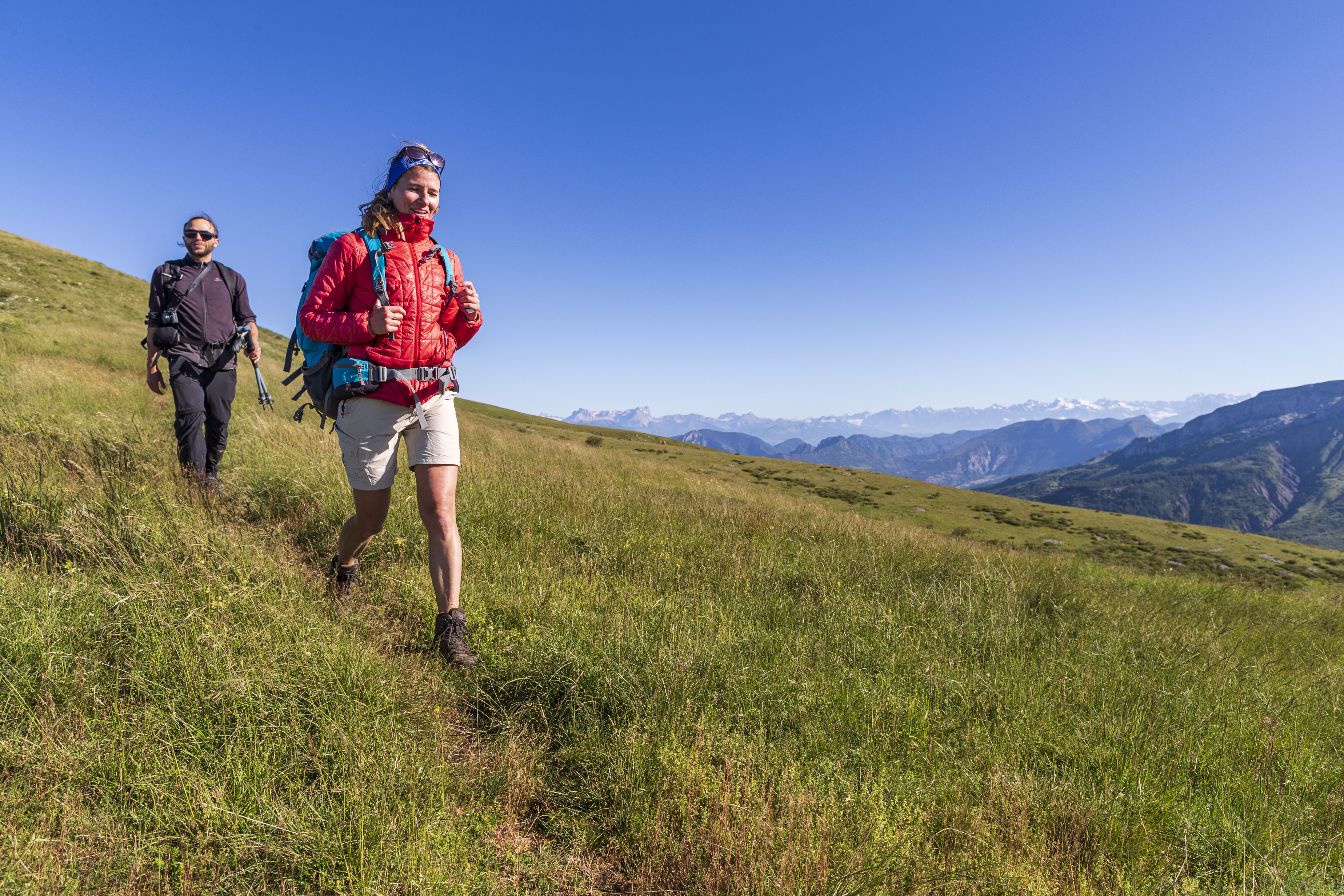
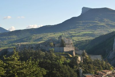
Nestled in the heart of the UNESCO Haute-Provence Geopark, the Vançon Valley reveals its mineral landscape over the course of a 4-day hike.
Starting from Sisteron, you’ll quickly reach the Monges Massif and its villages, where time seems to stand still and you’ll feel as though you’ve reached the end of the world. The traces of a rich geological history come into view.
300 million years have shaped this landscape, where you’ll see the different layers that have shifted due to intense tectonic activity.
The Vançon River, for its part, has left its mark by carving out this valley. You’ll spot, for example, gypsum blocks in the black marl!
After days of exploring this region, you’ll be delighted to find cozy accommodations each evening. Delicious homemade meals, made with local ingredients, will give you the energy you need to continue your journey. Don’t forget your lunchbox to take along the picnic your hosts have prepared with care!
A hiking route accessible to everyone, perfect for a first-time experience.
Source: www.sisteron-alpesprovencales.fr
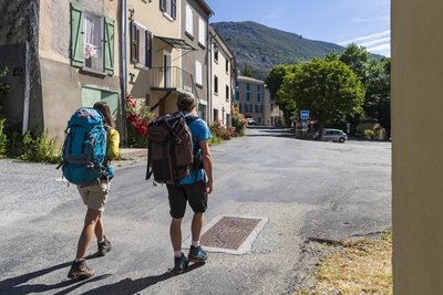
- Departure : Climbing site of La Baume, Sisteron
- Arrival : Climbing site of La Baume, Sisteron
- Towns crossed : Sisteron, Entrepierres, Saint-Geniez, Authon, Valavoire, and Castellard-Mélan
Forecast
Altimetric profile
Recommandations
WARNING: On this route, you may encounter livestock guard dogs tasked with protecting herds from wolf attacks.
To minimize the risk of conflict, bringing pets is strongly discouraged, even if they are on a leash.
Cyclists, please be especially vigilant: upon seeing a herd, you must get off your bike, stop, and allow the dogs to assess you. Then, give the herd a wide berth, keeping your bike between you and the livestock guard dog.
In any case, stay calm, avoid sudden movements, and do not attempt to cross through the herd.
→ To learn more about how to behave around livestock guard dogs: https://rando.sisteron-alpesprovencales.fr/information/14-Les-patous-et-nous-!
Information desks

1 place de la République, 04200 Sisteron
Transport
Let’s limit car travel and consider public transportation and carpooling: https://zou.maregionsud.fr
Access and parking
From Sisteron (1 km), exit through the tunnel under the citadel and take Route D951 toward La Motte-du-Caire to reach the Baume Bridge.
Parking :
Parking lot of the climbing site of La Baume, Sisteron
1 point of interest
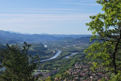
La Durance - CCSB  Lake and river
The Durance River
More than a mere river, the Durance is a force of nature. From its source in Mongenèvre at an altitude of 2300 metres it rolls its way over 302 kilometres until it finally flows into the Rhône. Over time, there has been greater control by man over the river, particularly with the construction of the Serre-Ponçon dam, and it is an essential artery for the Hautes-Alpes.
Source : www.hautes-alpes.net
More information
Report a problem or an error
If you have found an error on this page or if you have noticed any problems during your hike, please report them to us here: