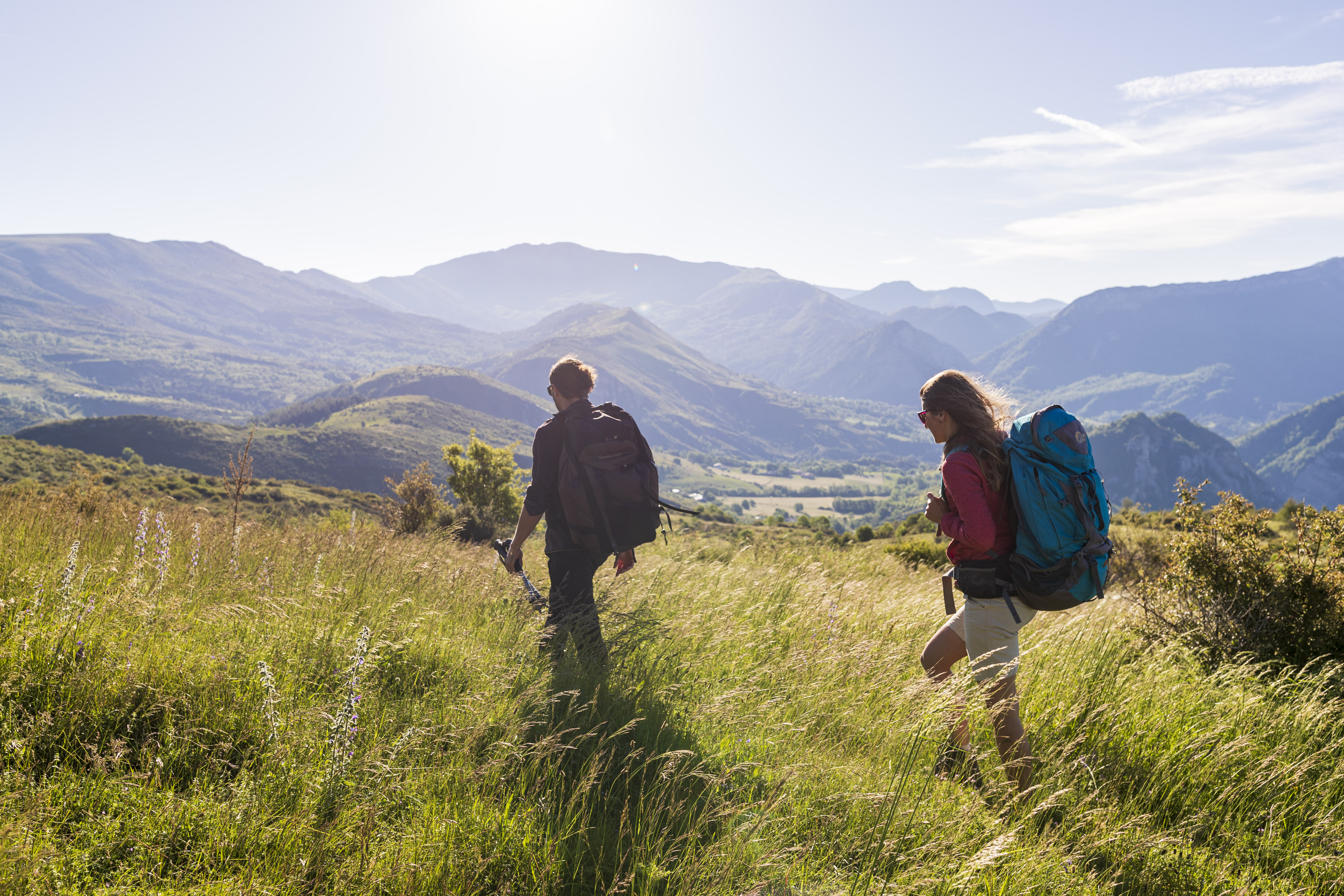
Tour des Monges
Thanks to the geological diversity of the soils, pastoral activity (transhumance since the Middle Ages), and the dual climatic influence—Alpine and Mediterranean—the Monges are home to a rich variety of plant and animal life. Certain biotopes are classified at the European level for their faunal and floral significance (ZNIEFF, Natura 2000) .
The Monges massif combines the characteristics of two climates (Mediterranean in the southwest and Alpine in the northeast): the mild temperatures of the Mediterranean, hot and very sunny summers, light and pure air, and the coolness of the mountains. Rainfall can be as intense as in the Mediterranean climate (sudden thunderstorms), and winter reminds us that we are in the mountains with the presence of snow.
6 steps
Description
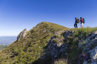
After climbing the small peak of Trainon, the route passes through Authon before following the ridges to reach the highest point of the Sisteronais-Buëch, the summit of theMonges, at an altitude of 2,115 meters. Just below, Lac des Monges is a must-see stop on the circuit, with its mountain hut situated near the water.
After Esparron-la-Bâtie, the route follows the D1, where it is possible to hitchhike or arrange a vehicle transfer to Clamensane.
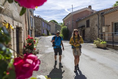
In the Sasse Valley, the route passes through the villages of Nibles and Châteaufort before returning to Saint-Geniez and then to the starting point.
- Departure : Tourist Information Office, Sisteron
- Arrival : Tourist Information Office, Sisteron
- Towns crossed : Sisteron, Entrepierres, Saint-Geniez, Authon, Valavoire, Bayons, Clamensane, Motte-du-Caire, Nibles, Vaumeilh, Châteaufort, and Valernes
Forecast
Altimetric profile
Recommandations
To minimize the risk of conflict, bringing pets is strongly discouraged, even if they are on a leash.
Cyclists, please be especially vigilant: upon seeing a herd, you must get off your bike, stop, and allow the dogs to identify you. Then, give the herd a wide berth, keeping your bike between you and the guard dog.
In any case, remain calm, avoid sudden movements, and do not attempt to cross through the herd.
→ To learn more about how to behave around guard dogs: https://rando.sisteron-alpesprovencales.fr/information/14-Les-patous-et-nous-!
- To avoid walking along the road section (D1), you can arrange for a ride (contact the Sisteron les Alpes Provençales Tourist Office for information) or hitchhike (www.rezopouce.fr) from Pont de Reynier to Clamensane or Nibles.
- These stages are provided for informational purposes only. You may modify them as you see fit. Several options are available for spending the night in a cabin or a few kilometers from the proposed route (Refuge du Seignas, Lac des Monges Cabin, Gîte Retrouvance® du Lac des Monges, Gîte de la Maison d'Alix in Reynier).
- At the end of the 5th stage, you can arrange a vehicle transfer back to Sisteron or start over at Stage 1 by adding an extra day of hiking.
Information desks

1 place de la République, 04200 Sisteron
Transport
Access and parking
Parking :
7 points of interest
La Durance - CCSB  Lake and river
The Durance River
More than a mere river, the Durance is a force of nature. From its source in Mongenèvre at an altitude of 2300 metres it rolls its way over 302 kilometres until it finally flows into the Rhône. Over time, there has been greater control by man over the river, particularly with the construction of the Serre-Ponçon dam, and it is an essential artery for the Hautes-Alpes.
Source : www.hautes-alpes.net Lake and river
La Bastié source
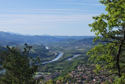
This route goes up onto the wild ridges between the Monges summit and Jouère summit. The rise through the forest allows you to reach the Sapie pass where the landscape opens onto mountain pastures and offers a great panoramic view on the surrounding mountains and further, the Durance valley.
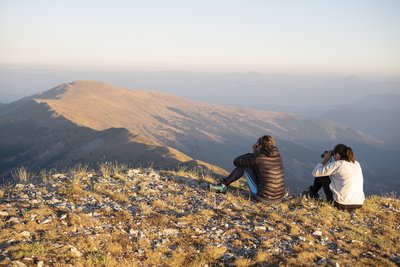
- Panorama
Orientation table
At the summit of Coste Belle, located just a few meters from the highest point of the Monges hike, a semi-circular orientation table was installed in 2017, highlighting the many peaks visible on the horizon. From this panoramic viewpoint, you can spot the peaks of the Vercors, Dévoluy, Ecrins, Queyras, Ubaye, Mercantour, Verdon, and Luberon mountain ranges. 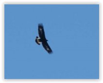
Office de Tourisme La Motte du Caire  Fauna
FaunaGolden Eagle (Aigle royal)
This “king of birds” or bird of Zeus regularly soars over the entire mountain range, leaving no animal indifferent. Marmots whistle if he gives them the chance, other birds flutter about, while the chough or, at times, the raven, scolds him.
The royal attribute, beyond its appearance, its flight, the stern gaze it seems to possess, and the strength of its beak and talons, has long been associated with the power of the one it seems to embody: the monarch. Yet, in ornithological terminology, this term means nothing other than “true” or “real.” The Golden Eagle is therefore above all the true eagle, the genuine eagle. Capable of living for over 25 years, this “king of birds” possesses vision eight times more acute than that of a human. Its nesting site generally consists of several nests or roosts in which one or two young attempt to survive. Very often, a lack of food proves fatal to the youngest chick. Once it leaves the nest, the young eagle is easily recognizable by the clearly visible white spots on and under its wings and tail: the distinctive markings clearly visible in our photo.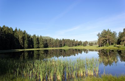
Au printemps - Office de Tourisme La Motte du Caire Lake and riverMonges lake
Lake des Monges is an artificial lake created in 1970 when the forest road was opened. Originally, the site was a marsh, and with the construction of the dam, the lake gradually formed (fed by snowmelt and rainfall).
Its depth varies significantly, ranging from 1.80 m to 2 m.
The Sisteron Fishing Association has carried out numerous stocking efforts (with various species: trout, Arctic char, carp, etc.), but only the tench have survived.
Fishing is permitted (standard fishing license required).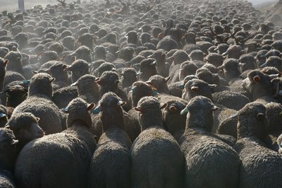
Office de Tourisme La Motte du Caire 
The transhumance
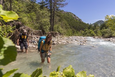
In the past, from Provence to the Southern Alps, vast herds would make their way to the Alps as summer approached. These transhumances (from the Greek “trans,” meaning “across,” and “humus,” meaning “soil”) took place along mountain trails or paths reserved primarily for the movement of herds. These routes played a vital role in attracting people, fostering strong local economies, as well as shaping culture, architecture, biological diversity, and the environmental value of the region. On this trail, you find yourself in the heart of one of these transhumance routes (after descending through the beech forest to the pastures of Clapouse). Today, most livestock is transported by livestock trucks. Nevertheless, come fall, the bleating of sheep and the ringing of cowbells still echo across these highlands of Provence.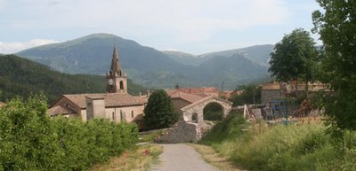
La Motte du Caire - Office de Tourisme La Motte du Caire  Flora
FloraLa Motte du Caire sequoias
By the end of the 19th century, erosion had reached catastrophic levels in the Southern Alps. The cause was centuries of rampant deforestation, which left bare soil vulnerable to runoff.
Several laws were successively enacted, giving the government the authority to intervene—sometimes against the will of residents who were unaware of what was at stake.
Forest houses were built to house Water and Forestry personnel and to prepare for future plantings using the surrounding nurseries.
Numerous experiments were conducted to establish the Austrian black pine as the preferred species for reforestation.
But foresters liked to shade their homes with majestic and decorative exotic species, such as the redwoods and cedars seen here.
Just north of La Motte du Caire, the Saignon basin is a good example of ongoing research into the evolution of these man-made forests. There is also a trail with educational resources (informational signs).
In the heart of the UNESCO Geoparc of Haute-Provence, some sites mention reforestation and erosion: Brusquet forest parc, Demontzey parc (located at Labouret pass) and Draix experimental basins.
More information
Report a problem or an error
If you have found an error on this page or if you have noticed any problems during your hike, please report them to us here: