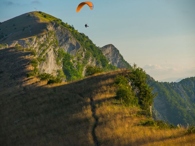
Crête de Chabre from Les Espranons
 Medium
Description
- From the orientation table at the Chabre launch site, the ridge walk leads to the Espranons launch site, the highest point on the ridge at 1,352 m. This launch site is known worldwide for its exceptional aerology.
- Continue along the scenic ridge, where rocky sections and forest trails alternate. Mostly open, the roller-coaster-like trail winds its way to Col Saint-Ange, a key pass between the Méouge Valley and the Baronnies.
- At Col Saint-Ange (1,266 m), return to the Chabre launch site by following the same route.
- Departure : Chabre Launch Site
- Arrival : Chabre Launch Site
- Towns crossed : Saléon, Nossage-et-Bénévent, Orpierre, Barret-sur-Méouge, and Sainte-Colombe
Forecast
Altimetric profile
Recommandations
- Bring plenty of water.
- Discover the Montagne de Chabre, a renowned spot for paragliding.
- Much of the trail is exposed, and it can get very hot there in the summer.
Information desks
Place des Aires, 05300 Laragne-Montéglin
Transport
Access and parking
From Laragne, head toward the Gorges de la Méouge.
After Châteauneuf-de-Chabre, head toward the hamlet of Pomet and follow a small road uphill to the Chabre launch site.
Parking :
1 point of interest

 Geology
Chabre Mountain
Overlooking the Buëch valley, Chabre Mountain is an unmissable massif of the Sisteronais-Buëch territory.
Well-known for its flight area, air competitions are often organised. Back in 2009, Chabre Mountain had welcomed the world hang-gliding championship.
It also is a massif with a lot of hiking routes. They offer wonderful views of Lure Mountain, the Écrins massif and Ventoux Mount.
A viewpoint indicator helps you to situate the different surrounding summits.
More information


Report a problem or an error
If you have found an error on this page or if you have noticed any problems during your hike, please report them to us here: