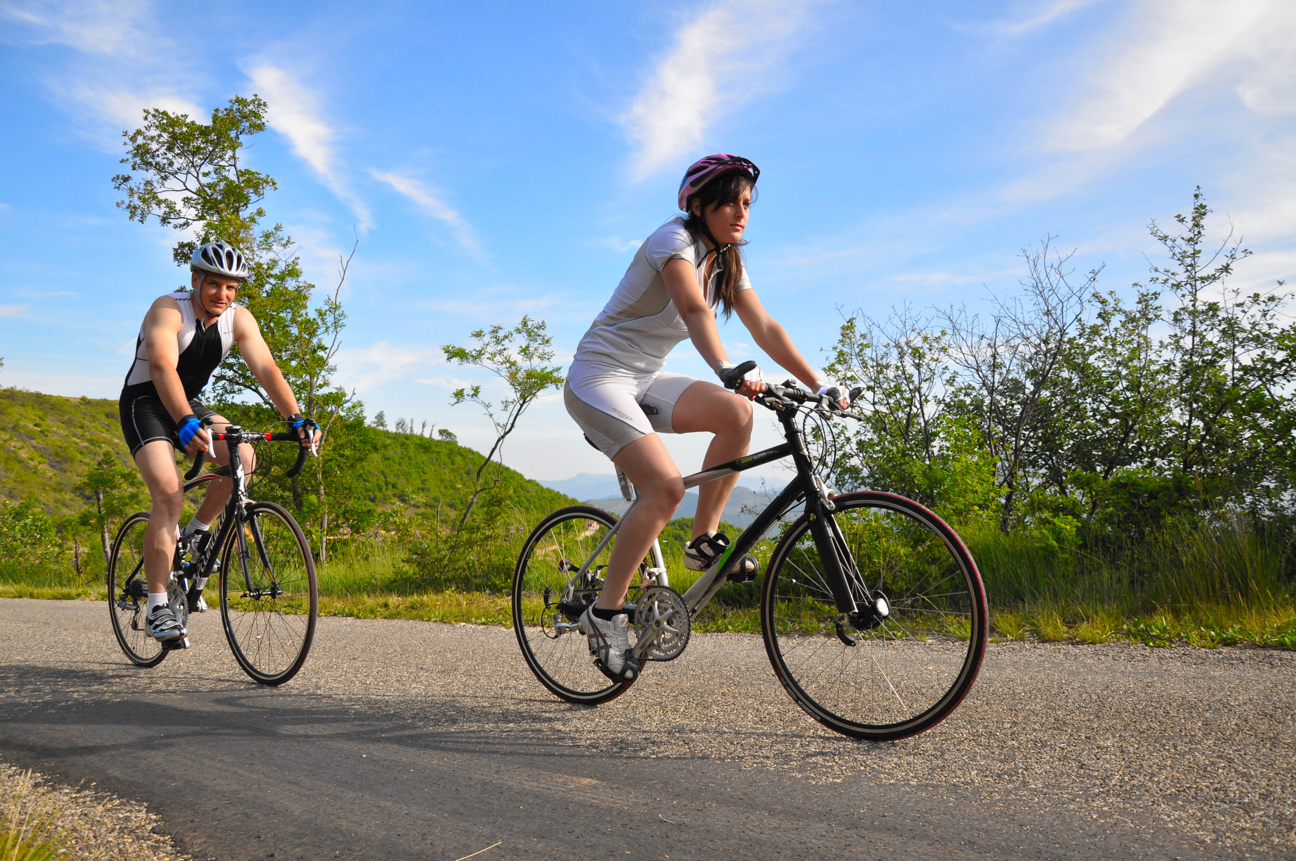
Tour de Fontbelle depuis Sisteron by bike
Sisteron Hard
Hard
Tour de Fontbelle depuis Sisteron by bike
1j
101,6km
+2533m
-2533m
Loop
Embed this item to access it offline
Description
- From the Pont de la Baume (left bank), take the D4 toward Volonne.
- Cross the N85 carefully and take the small road running parallel to it across the plain. Return to the N85 and follow it to the right until you reach Malijai.
- In Malijai (426 m), leave the N85 and turn right into the village. Cross the bridge. At the roundabout, take the second exit and turn left onto the D12. Leave it shortly after and turn left onto the D8 toward Le Chaffaut.
- At the D 8/D 12 intersection (490 m), continue straight on the D 12. Pass through the village of Le Chaffaut and, at the roundabout by the lake, continue straight toward downtown Digne-les-Bains.
- Cross the bridge over the Bléone and turn right at the roundabout onto Avenue de Verdun. Continue straight ahead, passing through the shopping area until you reach the roundabout on Route de Champtercier.
- At the intersection of Route Napoléon and the D 3 (560 m), turn right onto the D 3. Climb to Champtercier, cross the Pas de Bonnet (886 m), then descend on its northern slope. At the intersection with the D 17, turn right toward Thoard. Drive through the village, then rejoin the D 3 on the right.
- After the intersection of the D 3 and D 117 (753 m), at the next junction with the D 117, keep left on the D 3 and begin the climb up the Col de Fontbelle. Cross the pass (1,304 m) and descend to the villages of Authon and then Saint-Geniez. The route then follows the D 3 downhill to Sisteron.
- At the intersection of the D 3 and D 951 (450 m), turn left onto the D 951 and return to the starting point (Pont de la Baume).
- Departure : Tourist Information Office, Sisteron
- Arrival : Tourist Information Office, Sisteron
- Towns crossed : Sisteron, Entrepierres, Salignac, Volonne, Thoard, Castellard-Mélan, Authon, and Saint-Geniez
Forecast
Altimetric profile
Recommandations
- Bicycle service station (bike wash, air pump, water fountain) behind the Digne-les-Bains Tourist Office (bus station).
- The Sisteronais Buëch region has been certified as an “Espace Cyclosport” by the French Cycling Federation and meets quality standards for welcoming road cyclists.
Information desks

1 place de la République, 04200 Sisteron
Transport
- Let’s limit car travel and consider public transportation and carpooling: https://zou.maregionsud.fr
- Train des Pignes (Digne-les-Bains–Nice line): tourisme.trainprovence.com
Access and parking
From Gap (50 km), follow Route 85, then take the A12 from La Saulce to Sisteron.
Parking :
Alcazar parking lot in Sisteron
2 points of interest
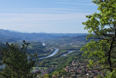
La Durance - CCSB  Lake and river
The Durance River
More than a mere river, the Durance is a force of nature. From its source in Mongenèvre at an altitude of 2300 metres it rolls its way over 302 kilometres until it finally flows into the Rhône. Over time, there has been greater control by man over the river, particularly with the construction of the Serre-Ponçon dam, and it is an essential artery for the Hautes-Alpes.
Source : www.hautes-alpes.net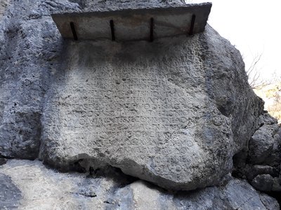
Pierre Ecrite - CCSB  History
Written Stone
This stone was engraved during the 6th century to recall the passage of Dardanus, powerful man, Christian and prefect of Gaul, corresponding with St-Augustin, , who came to retire to St-Geniez to found a "City of God" in the valley. A place bears the name of "Théous", but did "Theopolis" ever exist? And where exactly?
More information
Report a problem or an error
If you have found an error on this page or if you have noticed any problems during your hike, please report them to us here: