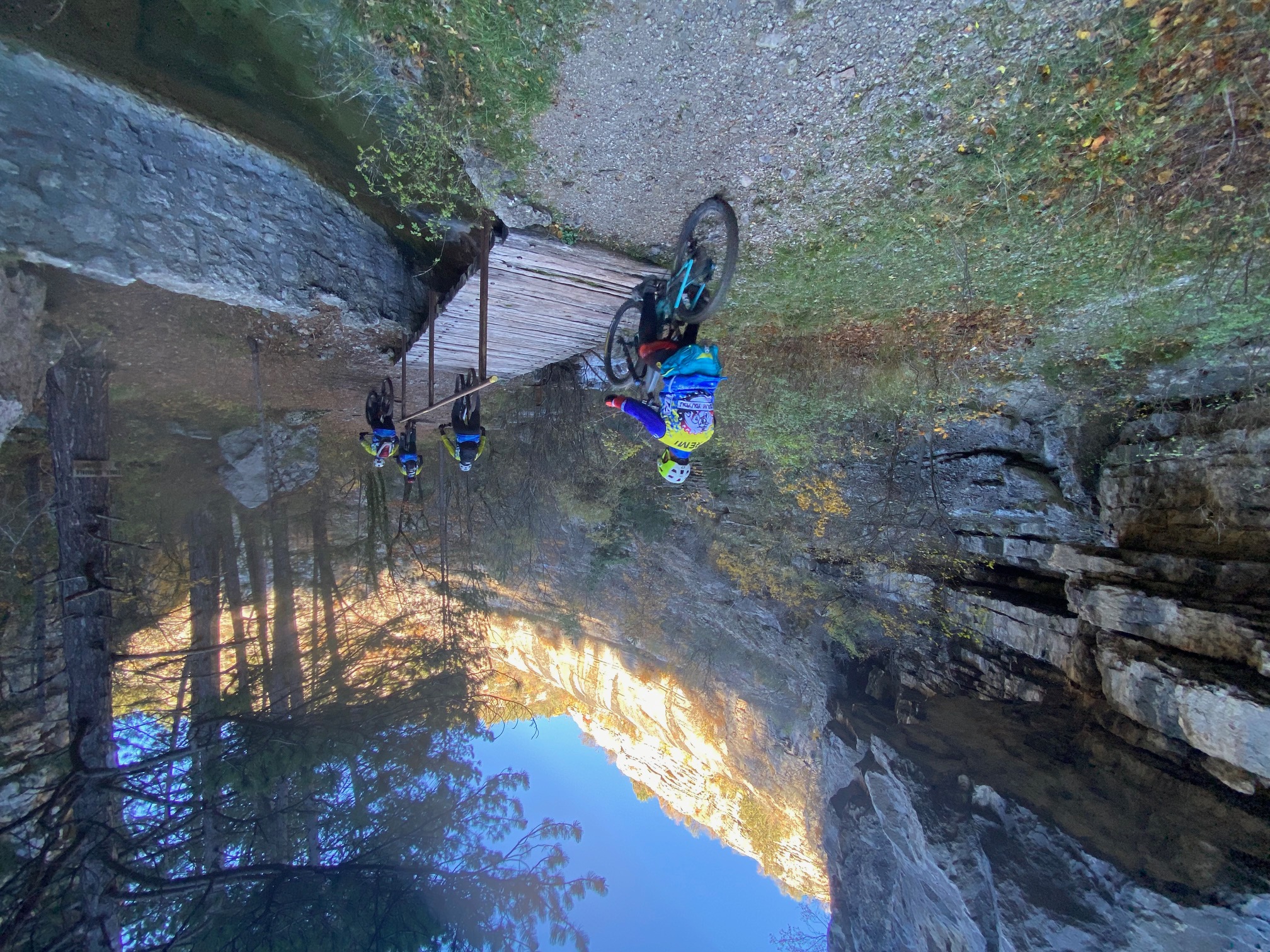
Grand Tour du Cirque de Jubéo by mountain bike
 Medium
Description
- At the town hall, follow the road up toward the village. Since the original trail has been affected by a landslide, you must go around this area. To do so, at the entrance to the old village, follow the road toward the cemetery. At the next hairpin bend, take the trail on the left. At the end of the bend, ignore the trail that branches off to the left (private property—no trespassing) and continue for about 50 meters. Leave the track and follow the path on the left that runs alongside a lavender field. Follow the path back up to the original trail that ascends the Riou Gorge (out of respect for the farmer and to preserve these private lands, please do not cut across the fields, but follow the markers along the edge. Otherwise, this damages the grass that will be mowed and creates new paths: the trail maintains the so-called “wild” tracks and thus encourages further use. Thank you).
- At the “Saume Longe” signpost, continue the ascent toward the Montagne de Saint-Genis and turn right onto the Château forest trail. The trail leads to the Col du Colombier, where a large intersection opens up in the pine forest.
- At the Col du Colombier, follow the trail opposite toward the Roc de l’Esculier. The route then branches right to climb and join a trail at the end of the track. This trail descends a little further toward the Pas de Jubéo.
- At Pas de Jubéo, continue down toward the Forest House on the right, making sure not to miss the short trail on the left—100 meters past the ONF gate—that leads directly there.
- At the Maison Forestière, continue left to reach the trail leading to the Riou Gorges. Finally, at the “Saume Longe” signpost, head back down the gorges along the same route you took on the way up.
- Departure : Town hall in St-Genis, Garde-Colombe
- Arrival : Town hall in St-Genis, Garde-Colombe
- Towns crossed : Garde-Colombe and Savournon
Forecast
Altimetric profile
Information desks
Place du village, 05700 Orpierre
Place du Lac, 05700 Serres
Access and parking
Parking :
4 points of interest

 Lake and river
Riou canyon
Taking its source in the heart of the national forest of Beynon, the Riou dug its gorges. The Gorges du Riou connects the Jubéo Forest and the village of Saint-Genis.
 Pass
PassColombier pass
Colombier pass located at 1160 meters high, splits up the two Aup mountain’s sides – Aup is another name for Saint-Genis Mountain –. From the pass, you can go to many villages like Lazer, Eyguians, Saint-Genis and Savournon.
- Panorama
Viewpoint
When you reach the higher up part of the first big rise of the path, there is an overview on Laragnais valley and Saint-Genis town and Corrie.
- Lake and river
The Riou
The Riou takes its source at the bottom of the valley, digging beautiful gorges. It then comes to fill the Riou lake, very popular spot among tourists and locals during hot Summer days.
More information


Report a problem or an error
If you have found an error on this page or if you have noticed any problems during your hike, please report them to us here: