Tour du Bois de Bûche
Sisteron Medium
Tour du Bois de Bûche
4h30
11,4km
+583m
-583m
Loop
Embed this item to access it offline
Description
- Behind the police station, take the nature trail that climbs into the Molard woods. At the antenna, ignore the trail that descends and take the trail that climbs up to the orientation table. From the orientation table, continue straight ahead on the trail through the oak grove toward the Col de la Mairie. At Le Molard, continue toward Col de la Mairie, alternating between open ridges and oak forests.
- At Rocher du Turc, turn left toward Chantemerle, following the yellow trail markers. The trail descends steeply toward the Jabron Valley, then joins a track that passes near two farms, continuing the descent toward the valley.
- Continue on the track, then, at a bend after a few houses, leave the track to rejoin a trail. Cross a stream and continue on the trail. Immediately, turn sharply left onto the trail that climbs through the marl. Continue on the path that winds past century-old oak trees and ancient crumbling walls.
- At the field, following the trail markers, take the clearly visible path through the scrubland of Spanish broom. Turn left into the broom to rejoin the trail that runs along the edge of the orchards.
- The track gives way to a paved road, flanked by fields that are sometimes cultivated, sometimes fallow. At the hamlet of “Chantemerle,” continue along the road to Sisteron.
- Departure : Behind the Police station, Sisteron
- Arrival : Behind the Police station, Sisteron
- Towns crossed : Sisteron and Val Buëch-Méouge
Forecast
Altimetric profile
Recommandations
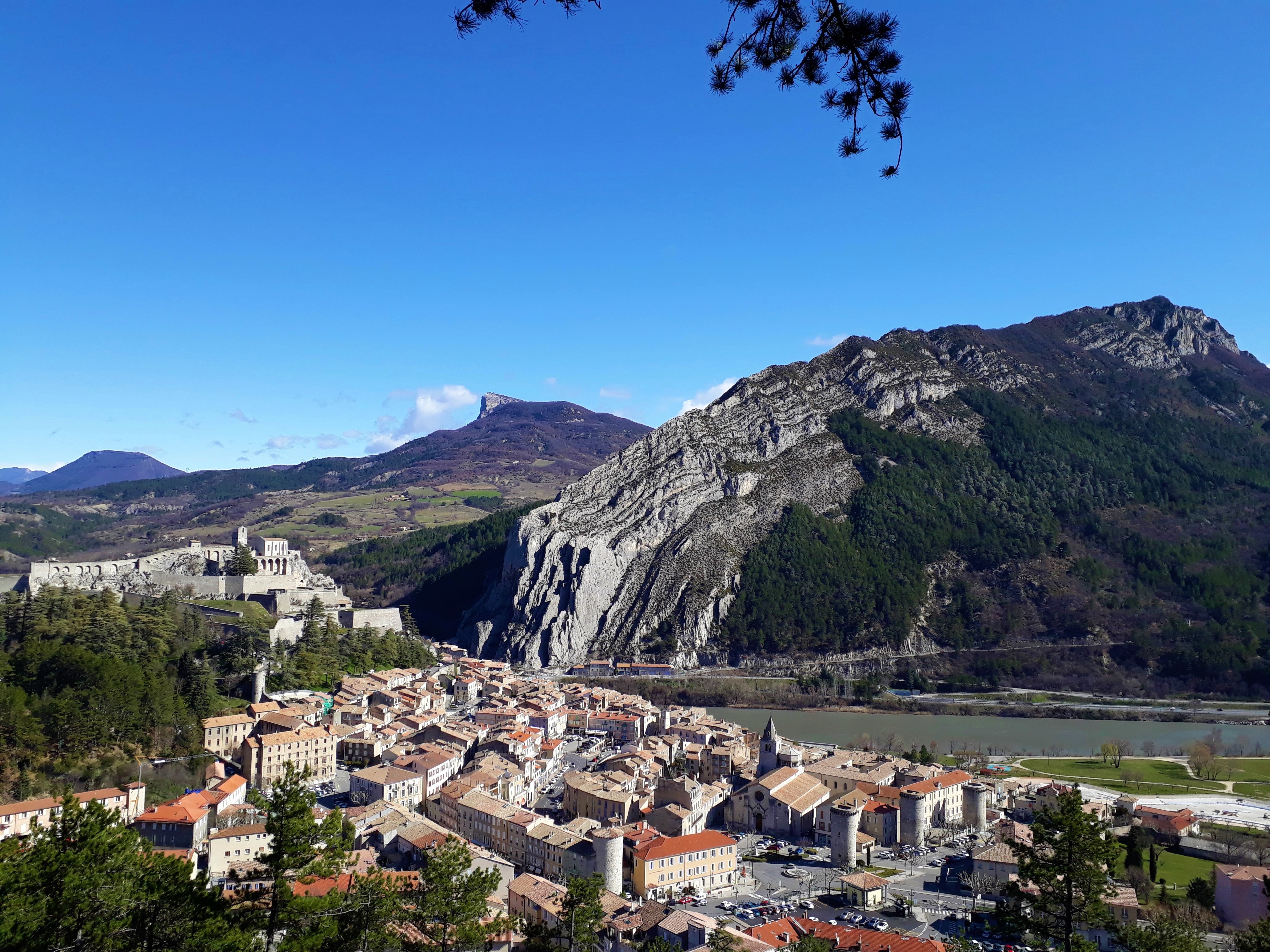
- We recommend visiting the Sisteron Citadel
- Please note: it may be closed in the summer (due to fire risk).
Information desks

1 place de la République, 04200 Sisteron
Transport
Let’s limit our trips and use public transportation and carpooling: https://zou.maregionsud.fr
Access and parking
From Gap (50 km), follow Route 85, then take the A12 from La Saulce to Sisteron.
Parking :
Police station, Sisteron
2 points of interest

 Flora
FloraMolard botanical trail.
The Molard botanical trail offers an enjoyable walk. Go in search of the region trees, shrubs, and plants. The interpretation boards allow you a better understanding and identification of the different plant species you can find during the trail.
- Panorama
The Molard viewpoint indicator
The Molard viewpoint indicator offers a wonderful outlook onto the village and the valley of Sisteron to the Laraganais. Thanks to the viewpoint indicator, you can easily notice and identify the different surrounding summits.
More information
Report a problem or an error
If you have found an error on this page or if you have noticed any problems during your hike, please report them to us here: