Les ruines de Maraysse by mountain bike
Valdoule Easy
Easy
Les ruines de Maraysse by mountain bike
2h
12,8km
+496m
-501m
Loop
Embed this item to access it offline
Follow the Mountain Bike Trail No. 4
Description
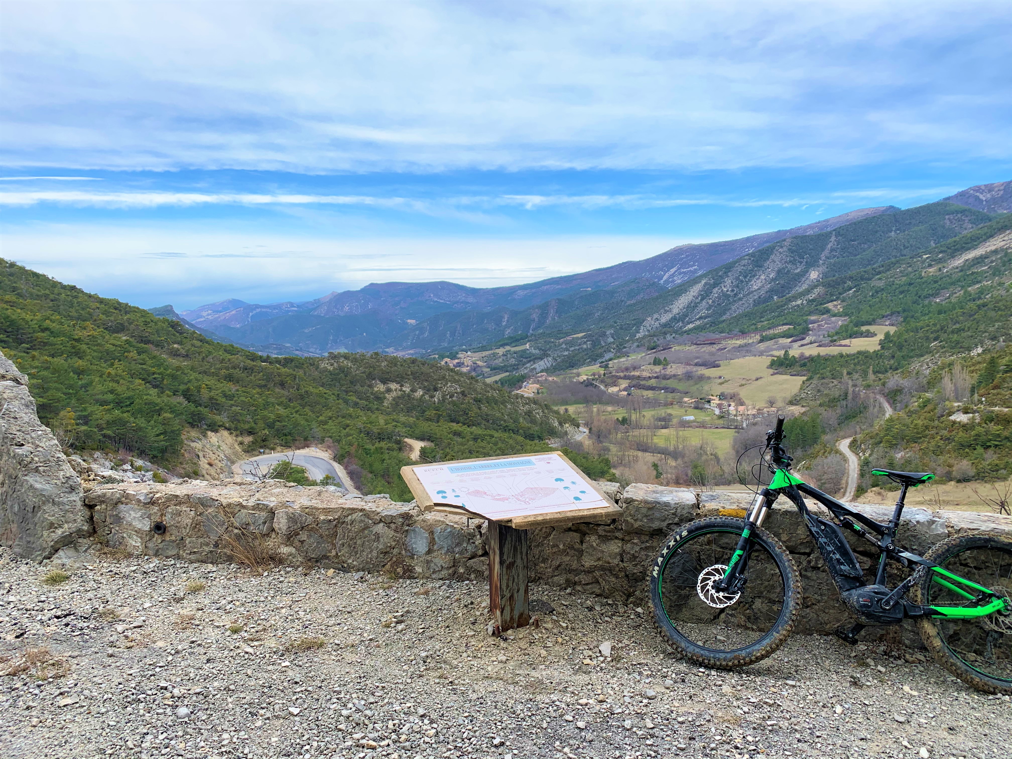
To start with, the route consists of 10 km of forest trail. With no difficulty on the ascent, this first section is easy to ride and shares the path with the Chemins du Soleil. A sign explains the history of forestry and agriculture in the Oule Valley. Shortly after the hamlet of “Les Garenses” (1,170 m), you can continue on the forest road (instead of taking the trail) for about 1 km until you reach the Maraysse ridge. There is a picnic table and a panoramic view from the ridge.
The final 3 kilometers, on the trail, are more technical with steep descents, ravines, and ruts. This section is ideal for enjoying a first foray into technical terrain. The hike ends on a pleasant, well-marked forest track before reaching the road leading to the heart of the village of Montmorin.
The final 3 kilometers, on the trail, are more technical with steep descents, ravines, and ruts. This section is ideal for enjoying a first foray into technical terrain. The hike ends on a pleasant, well-marked forest track before reaching the road leading to the heart of the village of Montmorin.
- Departure : Village, Montmorin
- Arrival : Village, Montmorin
- Towns crossed : Valdoule
Forecast
Altimetric profile
Information desks

Rue Aristide Briand, 05150 Rosans
Transport
Let’s limit our trips and use public transportation and carpooling: https://zou.maregionsud.fr
Access and parking
From Serres (21 km), take the D 994 west. After L'Epine, follow the D 26 north to Montmorin.
Parking :
Village of Montmorin
More information
Report a problem or an error
If you have found an error on this page or if you have noticed any problems during your hike, please report them to us here: