
Pirivigier
Val Buëch-Méouge Easy
Easy
Pirivigier
Easy2h30
7,4km
+330m
-329m
Loop
Embed this item to access it offline
Description
- From the inn’s parking lot, take the road toward Laragne, and at the intersection, follow the small road leading to the school. When you reach the school, turn left onto “Chemin du Relais” to reach the hamlet of Grange Neuve (this is where the loop begins).
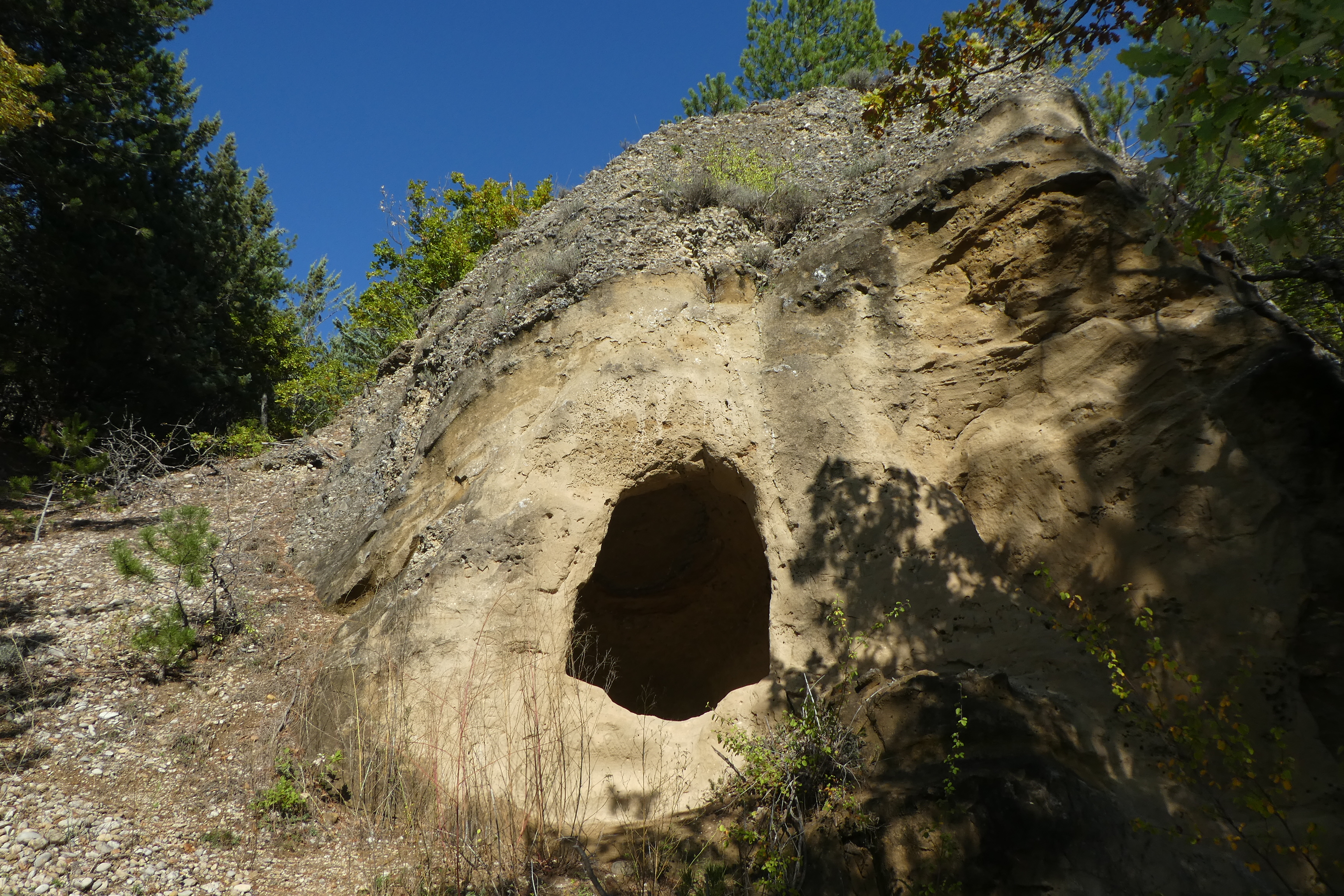
- In the hamlet, take the small paved road, lined with magnificent oak trees, which climbs and winds its way up to the last house on the hillside. Continue along the trail, passing a short distance further on by some cave dwellings carved into a sandy rock face (a sort of tower-like structure just past the small stream to the left of the trail). The path becomes a bit sandy, and rushes line the way. Here lie the ruins of the old village of Châteauneuf, steeped in centuries of history. Badger burrows line the trail, which begins to climb again.
- A few hundred meters further on, when you reach the ridge line, you can visit the castle ruins on the left. After enjoying the panoramic view of the meandering Buëch River, follow the ridge line up to the summit of Pirivigier, cross a pine forest, and then reach a vast pasture, which in June offers a magnificent flower-filled meadow (Montpellier Aphyllanthus). The trail continues to climb to a grove of pines (intersection with a mountain bike route).
- Take the trail on the left (barely marked) that descends along the dry meadow at the edge of the forest. The trail widens into a 4x4 track. Continue straight ahead, following the edge of the woods.
- When the trail curves to the right through a grove of small oak trees, take the path that veers sharply to the left. After 150 meters, at a trail junction, turn onto the path on the right. The view opens up onto Châteauneuf as the trail branches left through some pretty rock formations. Follow the trail’s switchbacks to reach a track on the left.
- Continue to the junction with the road.
- Follow the road to the right and return to the starting point by following the same route as on the way there.
- Departure : Parking lot at Auberge des 2 Vallées – Le Plan, Châteauneuf-de-Chabre
- Arrival : Parking lot at Auberge des 2 Vallées – Le Plan, Châteauneuf-de-Chabre
- Towns crossed : Val Buëch-Méouge
Forecast
Altimetric profile
Recommandations
- There are many points of interest along the way (a cave dwelling, a tower, and castle ruins).
- There is a fairly steep climb over 80 meters, but the rest of the route is very easy.
Information desks

Place des Aires, 05300 Laragne-Montéglin
Transport
- Let’s limit travel and consider public transportation and carpooling: https://zou.maregionsud.fr
- On-demand transportation to the Méouge Valley and the Drôme region (book 24 hours in advance): +33 (0)8 10 26 26 07
Access and parking
From Laragne (9 km), take the D 942, then the D 124 toward the Gorges de la Méouge, until you reach Plan de Châteauneuf-de-Chabre.
Parking :
Parking lot at Auberge des 2 vallées - Le Plan, Châteauneuf-de-Chabre
More information


Report a problem or an error
If you have found an error on this page or if you have noticed any problems during your hike, please report them to us here: