
Le Pas de Sainte-Colombe
Barret-sur-Méouge Easy
Easy
Le Pas de Sainte-Colombe
Easy2h30
7,1km
+264m
-264m
Loop
Embed this item to access it offline
Description
- At Col de la Crousette, continue along the flat trail. The start is a good warm-up; the slope is gentle.
- At the fork (944 m), turn right twice. Pass in front of a wooden hut until you reach marker 351.
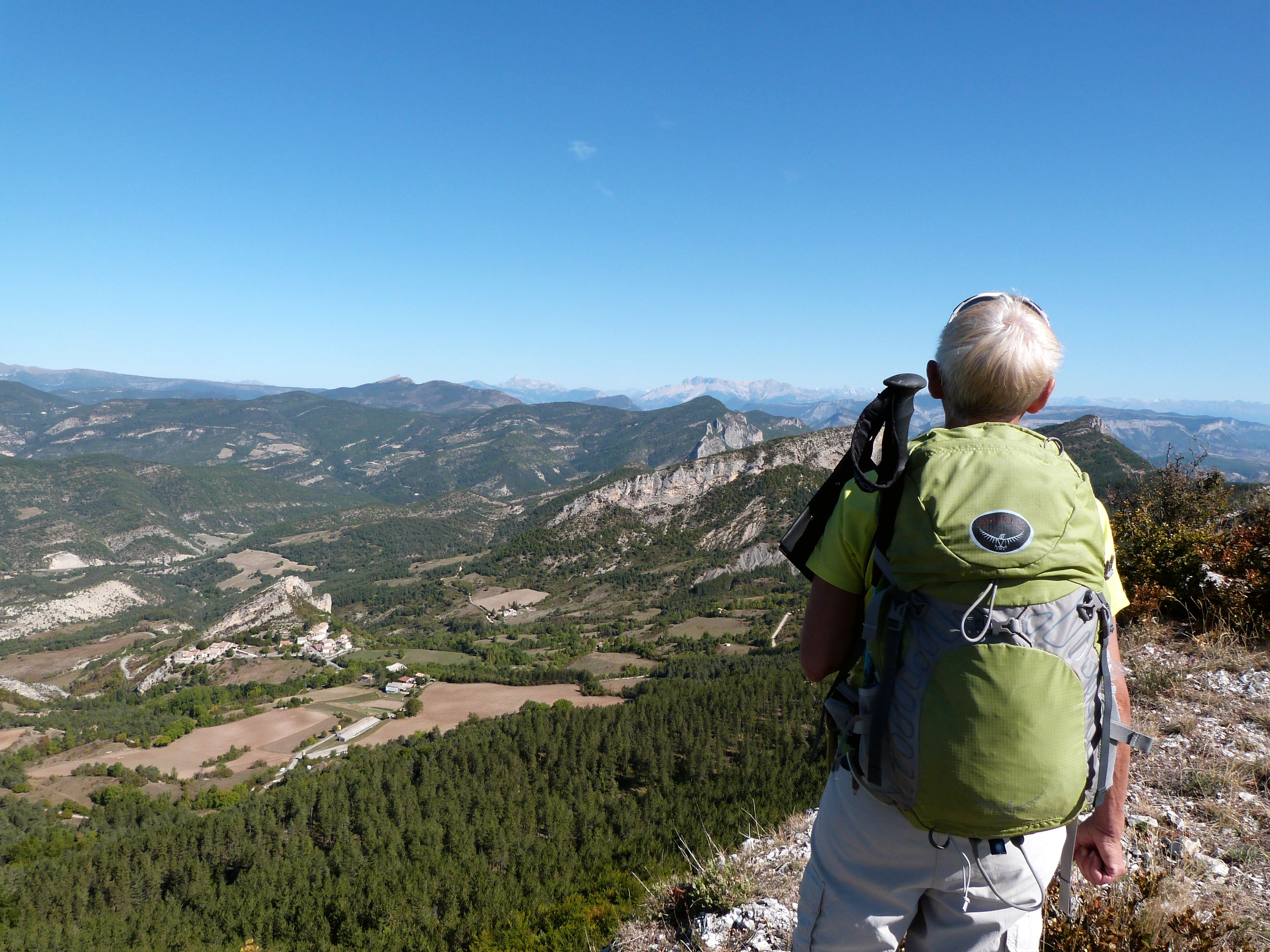
- At marker 351, turn right toward Col de Sainte Colombe. The slope steepens and quickly leads to a beautiful little hiking trail lined with thyme and a variety of flowers, offering a bird’s-eye view of the Méouge Valley. This lovely trail leads to the Montagne de Chabre trail.
- Just before reaching the Pas de Sainte Colombe (1,203 m), look for the trail on the left that you’ll need to take down. At the pass, hikers are treated to a panoramic view of the Céans Valley and Sainte Colombe. A break is welcome. The descent involves retracing your steps and then turning right at the hairpin bend.
- The trail gives way to a track; further down, take the track on the left, which leads straight ahead to the Col de la Crousette.
- Departure : Col de la Crousette, Barret-sur-Méouge
- Arrival : Col de la Crousette, Barret-sur-Méouge
- Towns crossed : Barret-sur-Méouge and Ballons
Forecast
Altimetric profile
Information desks
Place des Aires, 05300 Laragne-Montéglin
Transport
Let’s limit our trips and use public transportation and carpooling: https://zou.maregionsud.fr
Access and parking
From Laragne-Montéglin (15 km), follow the D 942 south toward Le Plan. Turn right toward the Gorges de la Méouge. From Barret, head toward Barret le Haut. Then turn left before Barret le Haut onto a dirt road: signs point toward “Col de la Crousette.”
Parking :
Parking lot at the Col de la Crousette, Barret-sur-Méouge
Accessibility
 Family
- Emergency number :
- 114
More information


Report a problem or an error
If you have found an error on this page or if you have noticed any problems during your hike, please report them to us here: