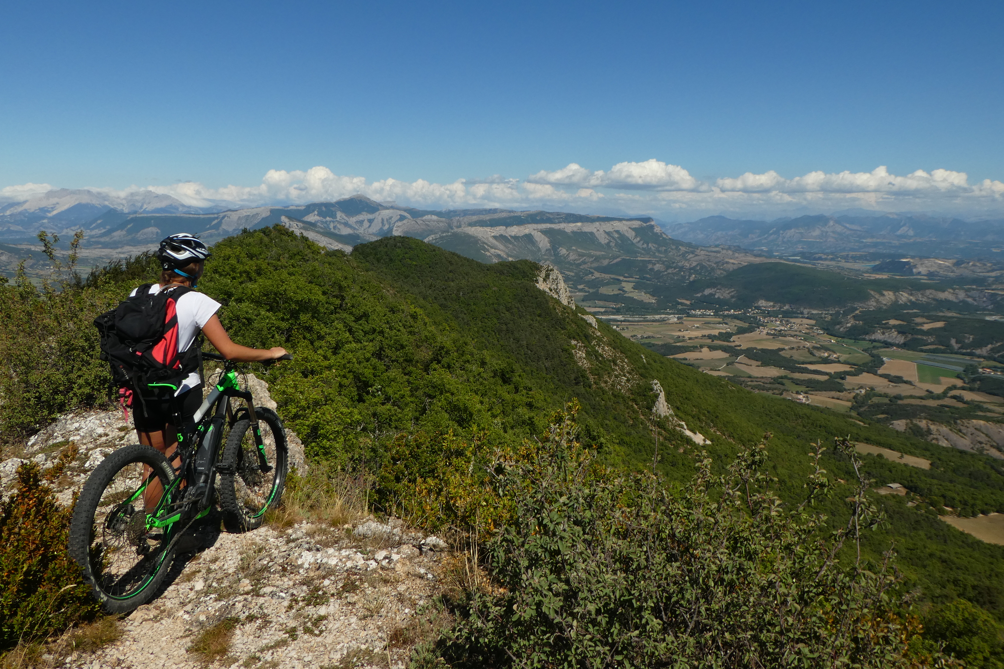
Tour du Suillet by moutain bike
Orpierre Hard
Hard
Tour du Suillet by moutain bike
2h
13,5km
+676m
-674m
Loop
Embed this item to access it offline
Follow the black Mountain Bike Trail No. 5
Description
- From Orpierre, take the RD 30 toward Laborel; at the Laborel/Villebois junction, turn right toward Villebois.
- Head uphill toward the hamlet of La Montagne, on the right.
- At a place called Les Faysses, leave the road and take the trail on the right. Cross the hamlet of La Montagne, then, 300 m further on, turn left.
- Take a somewhat steep trail on the right. At the pass, continue to the right.
- At the Font Salée ridge, follow the forest trail to the right.
- At the end of the trail, at a right-hand bend, take a path to the left. Admire the Trescléoux Valley to your left.
- Leave this path to take a small trail to the left through the beech forest. It climbs up to the ridge.
- At the junction with the GR®, take the ridge to the right. A short push or climb will be necessary before reaching the highest point of the hike.
- Once below the summit of Suillet, the descent can begin, heading toward Orpierre! (Leave the GR®)
- At the pass above St-Vincent, turn left. Caution: some sections of the descent toward Orpierre are very technical! About 1 km further on, be careful to turn right at the fork.
- Join the Chemin des Blaches, go straight ahead, then, at the intersection with the trail leading to the climbing cliffs, head downhill again.
- Descend through the housing development to the D 30.
- On the D 30, head right toward the Place d’Orpierre.
- Departure : Fountain next to the church, Orpierre
- Arrival : Fountain next to the church, Orpierre
- Towns crossed : Orpierre and Trescléoux
Forecast
Altimetric profile
Recommandations
WARNING: On this route, you may encounter livestock guard dogs tasked with protecting herds from wolf attacks.
To minimize the risk of conflict, bringing pets is strongly discouraged, even if they are on a leash.
Cyclists, please be especially vigilant: upon seeing a herd, you must get off your bike, stop, and allow the dogs to assess you. Then, give the herd a wide berth, keeping your bike between you and the guard dog.
In any case, remain calm, avoid sudden movements, and do not attempt to cross through the herd.
→ To learn more about how to behave around guard dogs: https://rando.sisteron-alpesprovencales.fr/information/14-Les-patous-et-nous-!
- Discover Orpierre, the climbing village (www.orpierre-escalade.com)
- Caution: technical descent and bike carrying. Suitable for expert riders only.
Information desks

Place du village, 05700 Orpierre
Transport
Let’s limit our trips and use public transportation and carpooling: https://zou.maregionsud.fr
Access and parking
From Laragne (13 km), take the D 1075, then the D 30 (Eyguians/Pont-Lagrand junction) to reach the town of Orpierre.
Parking :
Church's parking lot, Orpierre
More information
Report a problem or an error
If you have found an error on this page or if you have noticed any problems during your hike, please report them to us here: