
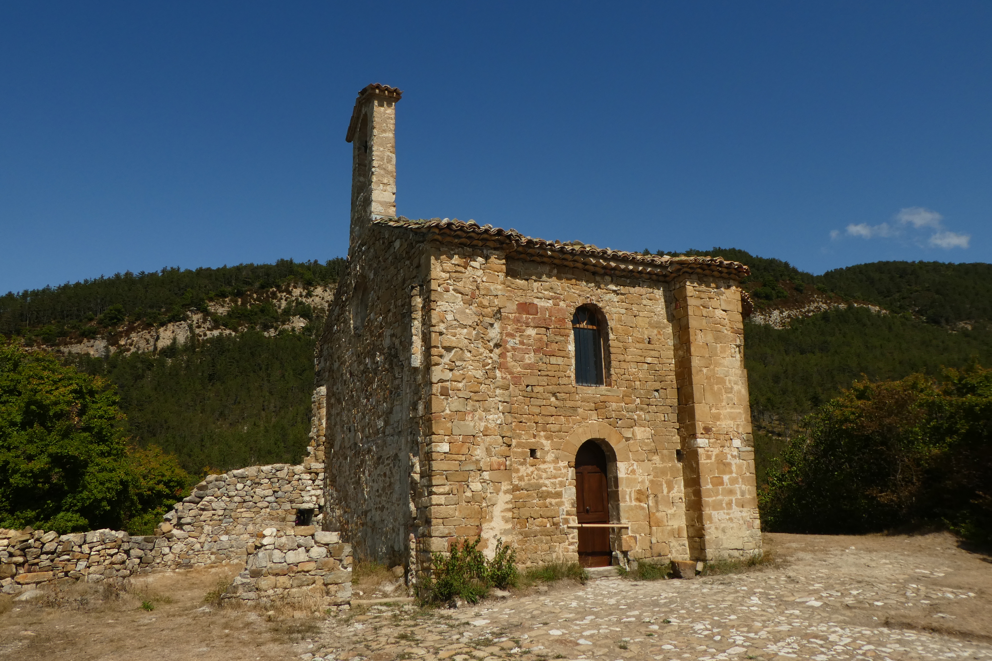
Saint-Cyrice chapel
Étoile-Saint-Cyrice Very easy
Saint-Cyrice chapel
Very easy2h
3,8km
+149m
-149m
Loop
Embed this item to access it offline
Description
- From le Moulin hamlet, keep on the departemental road D 130 towards Villebois-les-Pins and Etoile Saint-Cyrice 12th century church.
- Just before a bridge, take on your right a hairpin bends track hiking up to Saint-Cyrice public forest.
- In a left bend, leave the track and take the path in front of it. The chapel is a little bit further on the left. Turn left and take the path beneath the chapel and slightly go up to reach it’s hall.
- Once your tour at the chapel done, go down the path on the right side of the building, cross along the field fence to reach the forest.
- Go down the hairpin bends forest track.
- At the junction, turn right to reach back the Moulin Hamlet.
- Departure : Le Moulin hamlet, Etoile Saint Cyrice
- Arrival : Le Moulin hamlet, Etoile Saint Cyrice
- Towns crossed : Étoile-Saint-Cyrice
Forecast
Altimetric profile
Recommandations
- Discovery of Saint-Cyrice chapel, one of the oldest buildings of the Hautes-Alpes departement still covered.
- Passage on the path of the dry stones walls.
- This route is also available on the Geocaching app/website:
https://www.geocaching.com/geocache/GCAQ19Q_leglise-saint-cyrice
Information desks
Place du village, 05700 Orpierre
Transport
Let’s limit our trips and use public transportation and carpooling: https://zou.maregionsud.fr
Access and parking
From Laragne (17 km), take the departemental road D 1075 then the departemental road D 30 at Eyguians and Pont Lagrand turnoff. Follow the departemental roads D 130 and D 130a towards L’Etoile Saint-Cyrice to reach « le Moulin » hamlet. (The hamlet is located before the juction between Etoile Saint-Cyrice and Villebois).
Parking :
Parking lot in « le Moulin » hamlet at Etoile Saint Cyrice
More information


Report a problem or an error
If you have found an error on this page or if you have noticed any problems during your hike, please report them to us here: