Arambre summit
Serres Hard
Hard
Arambre summit
Hard3h30
7km
+793m
-793m
Return trip
Embed this item to access it offline
Description
- From the tourist office, cross the Buëch bridge and go up the street on the left and turn left once again.
- At the signpost, dive into the passageway on your right and go under the railway. Climb up through the hairpin bends path under box trees and pine trees. Bend right upon the ravine and after you reach a short slope turn left towards the Trou de la Lune (905 meters). Go straight on a steady rise until a junction (signpost “Le Sacre”, 1190 meters).
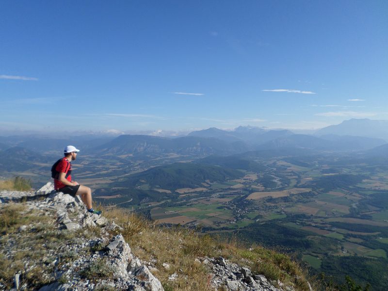
- Turn left and reach Arambre summit throughout screes zones. (1434 meters, 1h30 return trip)
- Enjoy the sumptuous panoramic view and go back to the departure point following the same route. Go back to Serres.
- Departure : Buech bridge, next to the Tourist Office
- Arrival : Buech bridge, next to the Tourist Office
- Towns crossed : Serres
Forecast
Altimetric profile
Recommandations
- It is not recommended to descend or ascend via the Claret stream (even though the trail is marked on the IGN map) because this route is no longer maintained or marked and passes through a long section of scree that can be tricky.
- Despite its modest elevation, the approach to the rock face is nonetheless challenging.
- On the way back from the hike, a visit to Serres is highly recommended. This village bears witness to a rich history with its vaulted passageways (soustets).
Information desks
Place du Lac, 05700 Serres
Transport
Let’s limit our trips and use public transportation and carpooling: https://zou.maregionsud.fr
Access and parking
From Laragne-Montéglin (17 km), follow the departmental road D 1075 at the north-west leading to Serres.
Parking :
Tourist office parking lot in Serres.
1 point of interest

 Lake and river
The Buëch River
A tributary of the Durance, the Buëch Riover is a peaceful river that irrigates many apple fields and other orchards along its course. Taking its source in Lus-la-Croix-Haute, the stream stretches for 85 kilometers and drops to an altitude of nearly 2,000 meters.
More information


Report a problem or an error
If you have found an error on this page or if you have noticed any problems during your hike, please report them to us here: