
Boucle des Hautes Terres de Provence by bike
Description
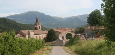
- From La-Motte-du-Caire (690 m), take the D 951 south. After 3.8 km, turn left onto the D 1 and follow the Sasse Valley along the right bank. Pass through the village of Clamensane (692 m), then the Bayons gorge, the hamlet of Forest-Lacour (817 m), and the village of Bayons (875 m), which leads to the famous “Tourniquets” and the Col des Sagnes (1,182 m). From there, take the short descent to Turriers.
- In the village (999 m), turn left onto the D 951A for 4.2 km.
- Continue left on the D 951 and cross the Col du Sarraut (980 m). Then descend through the villages of Faucon-du-Caire and Le Caire. While passing through, be sure to take a quick look at the village’s famous via ferrata. Complete the loop through the apple orchards.
- Departure : Main place in La-Motte-du-Caire
- Arrival : Main place in La-Motte-du-Caire
- Towns crossed : Gigors, Faucon-du-Caire, Caire, Motte-du-Caire, Clamensane, Bayons, Turriers, and Bellaffaire
Forecast
Altimetric profile
Information desks

Transport
Access and parking
Parking :
1 point of interest
La Motte du Caire - Office de Tourisme La Motte du Caire  Flora
FloraLa Motte du Caire sequoias
By the end of the 19th century, erosion had reached catastrophic levels in the Southern Alps. The cause was centuries of rampant deforestation, which left bare soil vulnerable to runoff.
Several laws were successively enacted, giving the government the authority to intervene—sometimes against the will of residents who were unaware of what was at stake.
Forest houses were built to house Water and Forestry personnel and to prepare for future plantings using the surrounding nurseries.
Numerous experiments were conducted to establish the Austrian black pine as the preferred species for reforestation.
But foresters liked to shade their homes with majestic and decorative exotic species, such as the redwoods and cedars seen here.
Just north of La Motte du Caire, the Saignon basin is a good example of ongoing research into the evolution of these man-made forests. There is also a trail with educational resources (informational signs).
In the heart of the UNESCO Geoparc of Haute-Provence, some sites mention reforestation and erosion: Brusquet forest parc, Demontzey parc (located at Labouret pass) and Draix experimental basins.
More information
Report a problem or an error
If you have found an error on this page or if you have noticed any problems during your hike, please report them to us here: