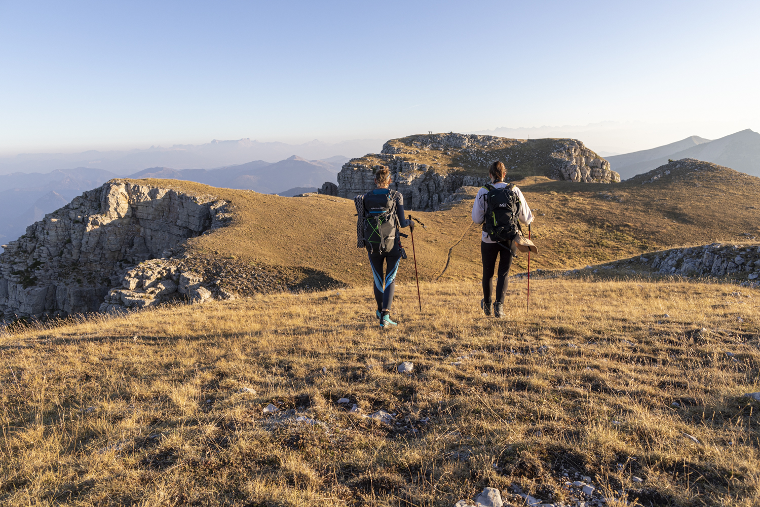
Sommet des Monges (from the Monges lake)
Bayons Hard
Hard
Sommet des Monges (from the Monges lake)
6h
13,1km
+821m
-819m
Loop
Embed this item to access it offline
Description
- From the parking lot, go through the ONF gate and follow the trail for 400 m to Lac des Monges.
- From Lac des Monges (1,544 m), follow the forest trail to the left until you reach the hamlet known as “Le Pradon.”
- At the “Le Pradon” junction, continue along the trail on the right, staying in the forest, until it ends.
- At the end of the trail, continue along the path that winds through the larch forest. Upon exiting the forest, a long traverse across the slope below the summit of Coste Belle leads to the Raus ridge.
- From the Raus ridge (1,892 m), take a steep trail to reach the summit of Coste Belle and its orientation markers.
- At Coste Belle (2,106 m), the trail continues along the ridge (entering a pasture guarded by Patou sheepdogs) to the summit of Les Monges.
- From the summit of Les Monges (2,115 m), head due east (no trail) and follow the markers while staying on the ridge. From a final outcrop, descend directly down a very steep grassy slope to the Col de la Croix de Veyre.
- At the Col de la Croix de Veyre (1,886 m), join the GR®6 and follow it north to the Col de Clapouse.
- At the Col de Clapouse (1,692 m), follow the GR®6 toward Le Pradon through pastures and forest. Finally, rejoin the ascent route and follow it in the opposite direction to return to the starting point.
- Departure : Monges lake, Bayons
- Arrival : Monges lake, Bayons
- Towns crossed : Bayons and Authon
Forecast
Altimetric profile
Recommandations
WARNING: On this route, you may encounter livestock guard dogs protecting herds from wolf attacks.
It is strongly discouraged to bring a pet dog, even if it is on a leash.
If you encounter a herd, stay calm: stop, let the guard dogs get a good look at you, then give the herd a wide berth without making any sudden movements.
→ To learn the proper precautions to take when encountering guard dogs, visit: https://rando.sisteron-alpesprovencales.fr/information/14-Les-patous-et-nous-!
- 2 must-see orientation tables at the summit
- The ascent begins in a forest and then continues along an exposed ridge—proceed with caution!
- The pasture at Coste Belle is guarded by Patou dogs—proceed with caution.
- This route crosses the Haute-Provence Geological Nature Reserve (a protected natural area).
Information desks

1 place de la République, 04200 Sisteron

Transport
Let’s limit our trips and use public transportation and carpooling: https://zou.maregionsud.fr
Access and parking
From Sisteron (39 km), take the D951, then just before La-Motte-du-Caire, follow the D1 toward Clamensane and on to Lac des Monges.
Parking :
Monges lake parking lot, Bayons
3 points of interest
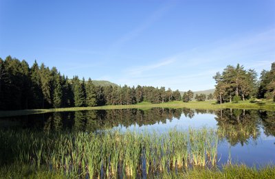
Au printemps - Office de Tourisme La Motte du Caire  Lake and river
Monges lake
Lake des Monges is an artificial lake created in 1970 when the forest road was opened. Originally, the site was a marsh, and with the construction of the dam, the lake gradually formed (fed by snowmelt and rainfall).
Its depth varies significantly, ranging from 1.80 m to 2 m.
The Sisteron Fishing Association has carried out numerous stocking efforts (with various species: trout, Arctic char, carp, etc.), but only the tench have survived.
Fishing is permitted (standard fishing license required).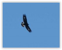
Office de Tourisme La Motte du Caire  Fauna
FaunaGolden Eagle (Aigle royal)
This “king of birds” or bird of Zeus regularly soars over the entire mountain range, leaving no animal indifferent. Marmots whistle if he gives them the chance, other birds flutter about, while the chough or, at times, the raven, scolds him.
The royal attribute, beyond its appearance, its flight, the stern gaze it seems to possess, and the strength of its beak and talons, has long been associated with the power of the one it seems to embody: the monarch. Yet, in ornithological terminology, this term means nothing other than “true” or “real.” The Golden Eagle is therefore above all the true eagle, the genuine eagle. Capable of living for over 25 years, this “king of birds” possesses vision eight times more acute than that of a human. Its nesting site generally consists of several nests or roosts in which one or two young attempt to survive. Very often, a lack of food proves fatal to the youngest chick. Once it leaves the nest, the young eagle is easily recognizable by the clearly visible white spots on and under its wings and tail: the distinctive markings clearly visible in our photo. Panorama
Orientation table
At the summit of Coste Belle, located just a few meters from the highest point of the Monges hike, a semi-circular orientation table was installed in 2017, highlighting the many peaks visible on the horizon. From this panoramic viewpoint, you can spot the peaks of the Vercors, Dévoluy, Ecrins, Queyras, Ubaye, Mercantour, Verdon, and Luberon mountain ranges.
More information
Report a problem or an error
If you have found an error on this page or if you have noticed any problems during your hike, please report them to us here: