Pic Saint-Cyr by mountain bike
Val Buëch-Méouge Hard
Hard
Pic Saint-Cyr by mountain bike
2h30
12,9km
+908m
-908m
Loop
Embed this item to access it offline
Follow the Mountain Bike Trail No. 9 (VTT N°9)
Description
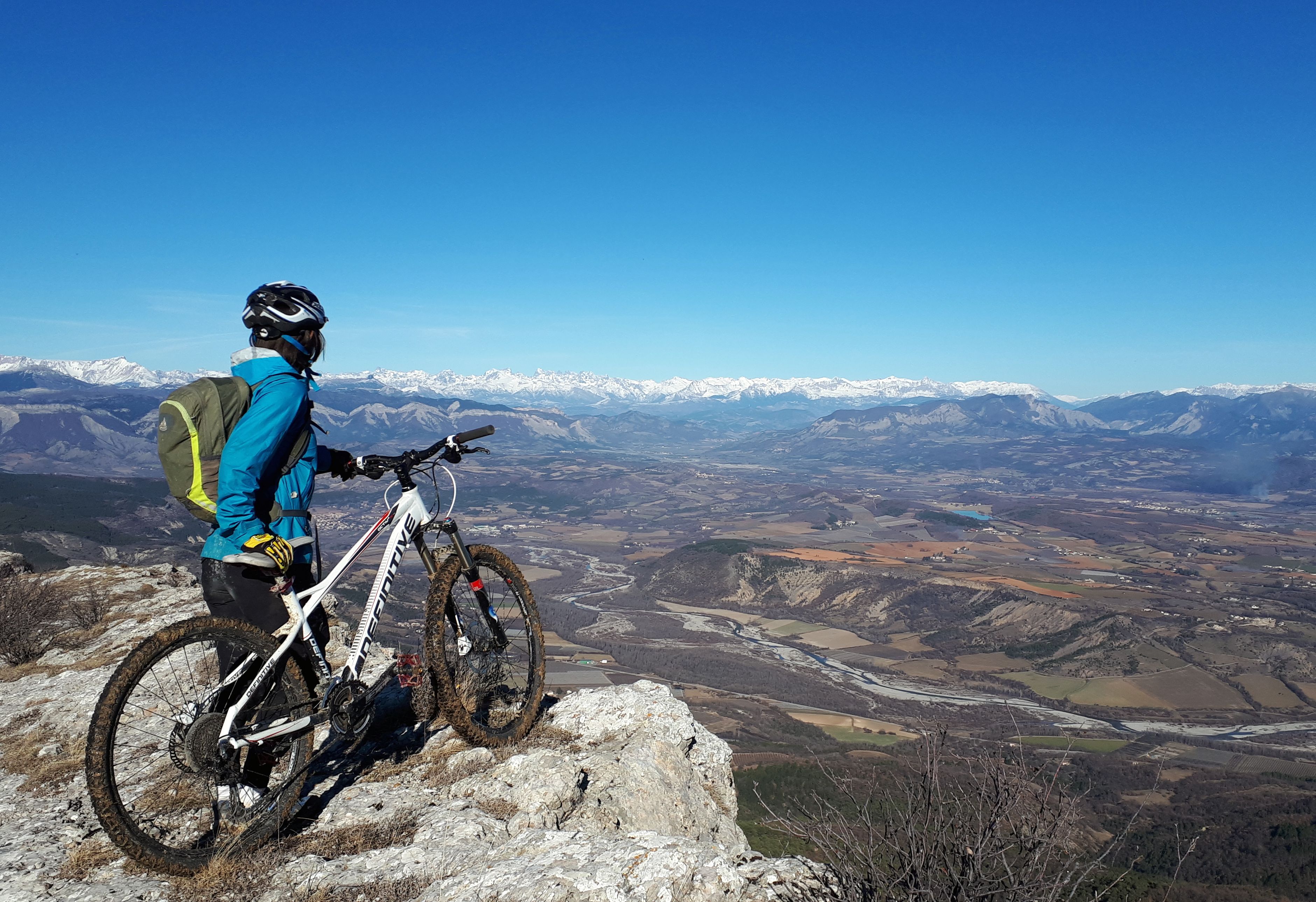
A very physically demanding route featuring a long, steady climb, a few sections where you’ll have to carry your bike, and a long, technical, and varied descent. This route offers several magnificent views of the region and the Méouge Gorges. In the spring, the ridge is covered with alpine flowers, especially peonies.
- Departure : Parking lot in Antonaves
- Arrival : Parking lot in Antonaves
- Towns crossed : Val Buëch-Méouge and Saint-Pierre-Avez
Forecast
Altimetric profile
Recommandations
Trail for experienced mountain bikers: a long, steep climb and a portage at the end.
Information desks

Place des Aires, 05300 Laragne-Montéglin
Transport
- Let’s limit our trips and consider public transportation and carpooling: https://zou.maregionsud.fr
- On-demand transportation to the Méouge Valley and the Drôme region (book 24 hours in advance): 08 10 26 26 07
Access and parking
From Sisteron (17 km), follow the D 948 to Antonaves (entrance to the Méouge Gorges).
Parking :
Parking lot in Antonaves
1 point of interest

 Geology
Saint-Cyr peak
Saint-Cyr peak offers a breathtaking view on the surrounding hamlets. When the weather is good, you can also observe from its ridge Ventoux Mount’s hilly area, the Platte summit and Chabre Mountain.
More information
Report a problem or an error
If you have found an error on this page or if you have noticed any problems during your hike, please report them to us here: