
Plateau de Saléon (N°20)
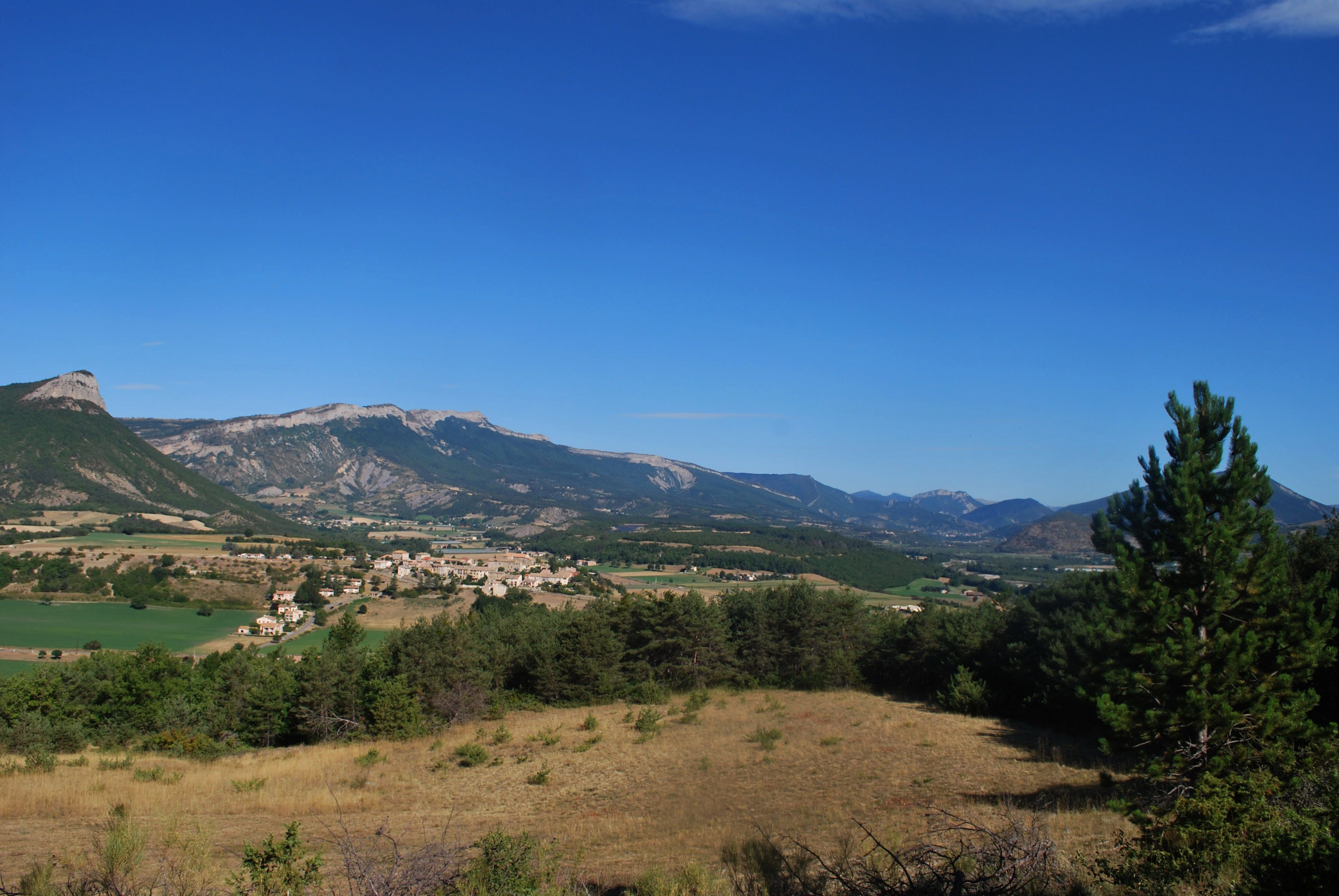
Saléon Very easy
Plateau de Saléon (N°20)
Very easy2h
4,2km
+178m
-173m
Loop
Embed this item to access it offline
This tour of the plateau offers a diverse range of landscapes, from the banks of the Buëch to the entrance to the Céans Valley—a region dotted with marl hills—and back through the more urbanized Laragnais area.
Description
- From the church, take the road leading down to the old village. Walk through the village until you reach the D 130b road on the left further down. Continue downhill to the Céans Bridge, then, just before the bridge, take the trail on the left. Walk uphill for 40 meters and turn right. The trail is bordered on the right by the Céans River and on the left by an old canal. Before heading up to the left, take the opportunity to visit the old aqueduct.
- Return to the trail and reach a flat area (viewpoint). Walk along a meadow on the right, cross a small wooded area, and emerge onto a track. Take it to the left and walk along the top of a field. After 150 m, take a trail that branches off to the right at the corner of the field. As you exit the woods, cross a path and follow the trail straight ahead that runs on level ground. At the fork, take the left trail and climb up to the junction with a wide track.
- At the signpost, take the wide track to the left to return to Saléon.
- At the intersection, turn right to reach the center of Saléon and the starting church.
- Departure : Chruch, Saléon
- Arrival : Chruch, Saléon
- Towns crossed : Saléon
Forecast
Altimetric profile
Recommandations
Open year-round
Information desks
Place du village, 05700 Orpierre
Place des Aires, 05300 Laragne-Montéglin
Transport
Let’s limit our travel and consider using public transportation and carpooling: https://zou.maregionsud.fr
Access and parking
From Laragne (7.5 km), take the D 1075 road, then the D 30 (Eyguians junction). At the first roundabout, take the third exit toward the village of Saléon (D 330); then, at the intersection, turn right and drive through the old village to reach the church.
Parking :
Church's parking lot, Saléon
More information


Report a problem or an error
If you have found an error on this page or if you have noticed any problems during your hike, please report them to us here: