Rocher Saint-Michel (N°5)
Description
- From the village square fountain, follow the D 30 towards Laragne, then take the small road on the right towards the Camping des Princes d'Orange and, after the bridge, go up the main road which runs alongside the campsite. Continue on the track until you reach a fork. Go up to the right on the main track. Pass in front of the old Paturle farm, ignore the path that goes to the right. Continue uphill until a second fork ( which is a variant via the Bessons plain).
-
Continue to the right on the GR and, after a long ascending crossing overlooking the ravine de Bagnols, you’ll reach an intersection (1031 m).
- Continue a few steps on a track and find, on the left, the path that winds steeply up and leads to a forest track.
- Follow then the yellow marked track to the left, continue to Collet de Bouzon (1126 m). Cross the ONF fence ( national forest Office) and continue until you reach the Saint Michel orientation table (1216 m).
- Take the path that curves to the left of the orientation table and descend along the ridge up to a fork.
- At that intersection, go down to the right direction "Orpierre par la Plaine des Bessons - 2.8 km". Cross the wooded plain, then descend the path until you’ll reach the track. The same way in reverse brings you to the church square.
- Departure : Church's place, Orpierre
- Arrival : Church's place, Orpierre
- Towns crossed : Orpierre and Sainte-Colombe
Forecast
Altimetric profile
Recommandations
- Caution : the descent is sometimes quite steep!
Information desks

Place du village, 05700 Orpierre
Transport
Let’s limit our trips and use public transportation and carpooling: https://zou.maregionsud.fr
Access and parking
From Laragne (13 km), take the D 1075 then the D 30 (Eyguians junction) to reach the district of Orpierre.
Parking :
2 points of interest

 Lake and river
The Ceans
Taking its source at the top of the mountain of Chamouse, the Ceans crosses all the Orpierrois-district before flowing into the Buëch at the level of Garde-Colombe. Over 22 km long, the torrent partly follows the route of the Princes of Orange.
 Geology
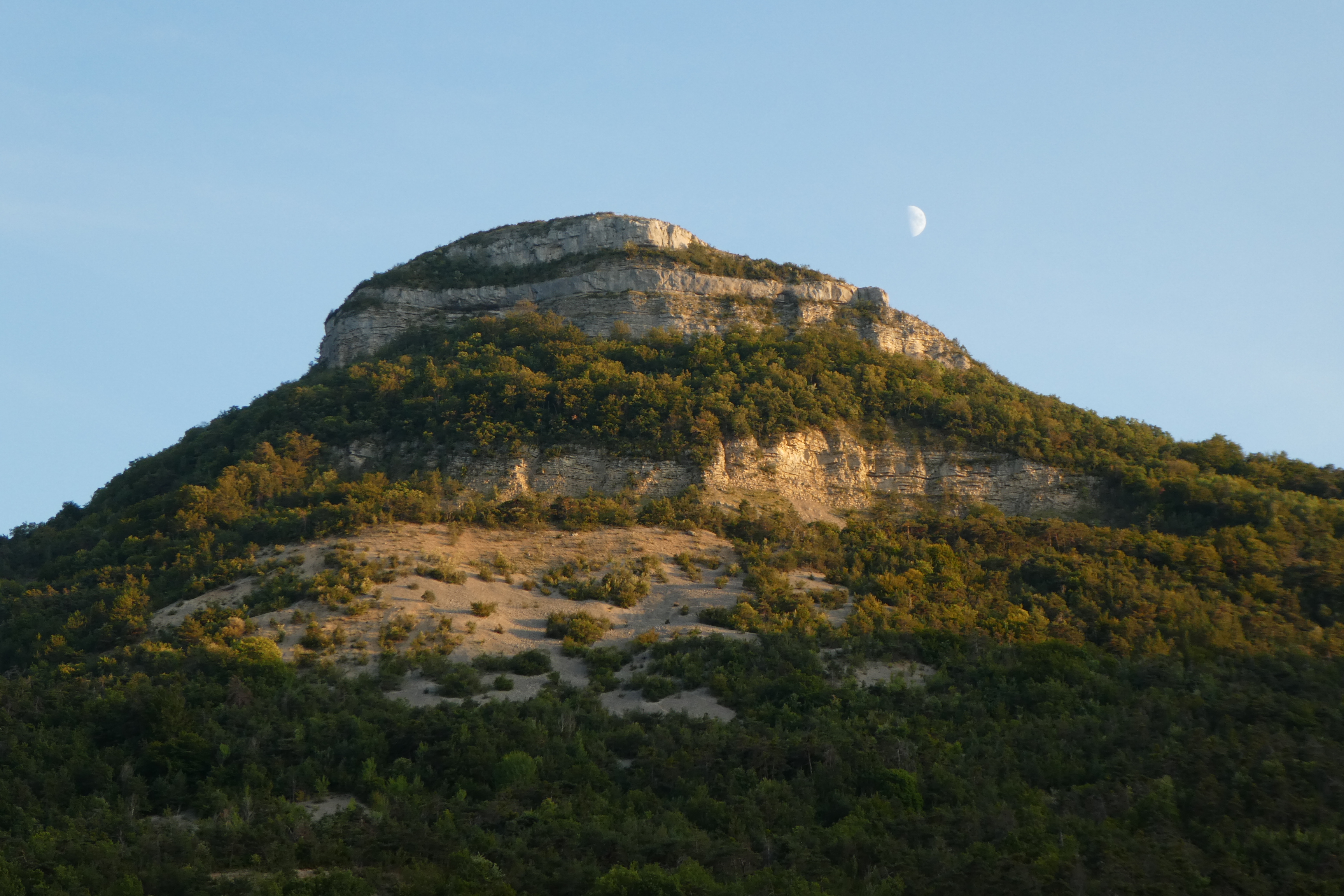
Rock of Saint-Michel
Overlooking the village of Orpierre, the Rocher de Saint-Michel allows you to discover a spectacular panorama the area of Orpierre and also a part of the Buëch area. Located at 1216 m, it offers in particular a spectacular view of the Laragne area and from its summit, on many surrounding massifs such as the Chabre, Aup or Saint-Genis mountains and futher the Dévoluy.
More information
Report a problem or an error
If you have found an error on this page or if you have noticed any problems during your hike, please report them to us here: